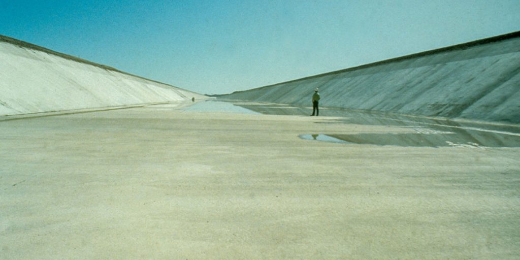
Water in the canal is flowing by gravity and generating friction where it is in contact with the canal lining on its bottom and sides. This friction slows the water down, so large pumps must lift the water up at various intervals along the CAP system to continue allowing it to flow by gravity through the canal. The original CAP design concepts were driven by economics as much as pure hydraulics. One example: the first portion of the canal which stretches 25 miles from Mark Wilmer Pumping Plant at Lake Havasu to Bouse Hills Pumping Plant is also wider and deeper – a neck-wrenching 80 feet wide at the bottom and 200 feet wide at the top. In a sense, this section serves as an “in-line storage reservoir,” allowing CAP to pump water from the river into this short-term storage area during off-peak hours when energy is cheapest. Meanwhile, flow can remain constant throughout the rest of the system. This gives flexible daily “shaping” of power usage as well. The canal bottom narrows as it progresses from the beginning of the system through the western and southern portions of the aqueduct. Over the course of the 336 mile-long system, the bottom width starts at 80 feet and whittles down to 12 feet. Geeky Engineering Fact: In canal design, variations of canal bottom width, longitudinal slope, side-slope, and canal depth are used to produce an appropriate canal shape for a desired flow and topography. A system designed primarily for economical efficiencies, CAP water flows reliably from Lake Havasu to Tucson, an engineering wonder that supplies water to more than 80 percent of the state’s population. Call it — if you so desire — trapezoidal technology.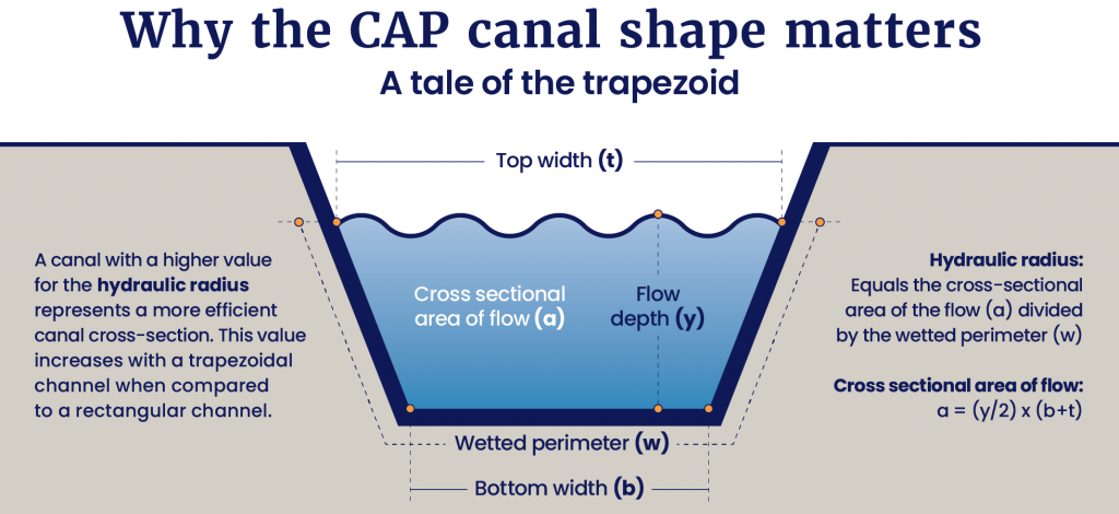
Start wide, end narrow — deliver reliably
The CAP: an engineering marvel